W@ssup
Cs Balala: Mt Longonot To Get A Cable Car
Travelog
Courtesy
Tourism Cabinet Secretary Najib Balala this morning led hiking enthusiasts on an expedition to the rim of Mt Longonot in another stab at raising awareness of Kenya's adventure tourism potential. Today’s morning hike also serves as an acclimatization drive, a pre-hike, to the grand climb up Mt Kenya that CS Balala will lead later in the month. The CS was accompanied on this hike by other dignitaries including the KWS Director General Brig (Rtd) John Waweru, KTB Acting CEO Allan Njoroge, Kenya Utalii College Principal & CEO, Prof Charles Musyoki, CEO of Wildlife Research and Training Institute, Dr Patrick Omondi and the Bomas of Kenya General Manager, Peter Gitaha.
In November 2017 Balala embarked on a five-day excursion to Mt Kenya’s Lenana peak to profile the snow-capped mountain as a favourable tourist destination. This time he will be returning on a conservation mission with a goal. Speaking after the pre-hike and flanked by various corporate sponsors including Visa, Safaricom M-Pesa, Sahihi Builders, KCB, Huawei, and Vipingo Ridge, the CS noted that despite its global status- it’s not every day that you find snow along the Equator- Mount Kenya has been silently battling a sanitation crisis amid strained outdated facilities. As if battling Acute Mountain Sickness (AMS) were not enough, it is improper that hikers often have to deal with sanitation duress as a result of few long drop toilets whose users are not very handy with.
With so many individuals concentrated in limited areas on the mountain, it is also vital to protect water sources from contamination. Another challenge Mount Kenya faces is the continued attrition of its glaciers. In the late 1800s there were 18 identified glaciers; today seven of those are completely gone. In recent decades the rate of recession has accelerated and it is estimated that there may be no permanent ice left on the mountain over the course of our lifetime. The disappearance of Mount Kenya’s glaciers will affect the water supply, potential income from tourism and will no doubt mark this inspirational hallmark off the Kenyan landscape.
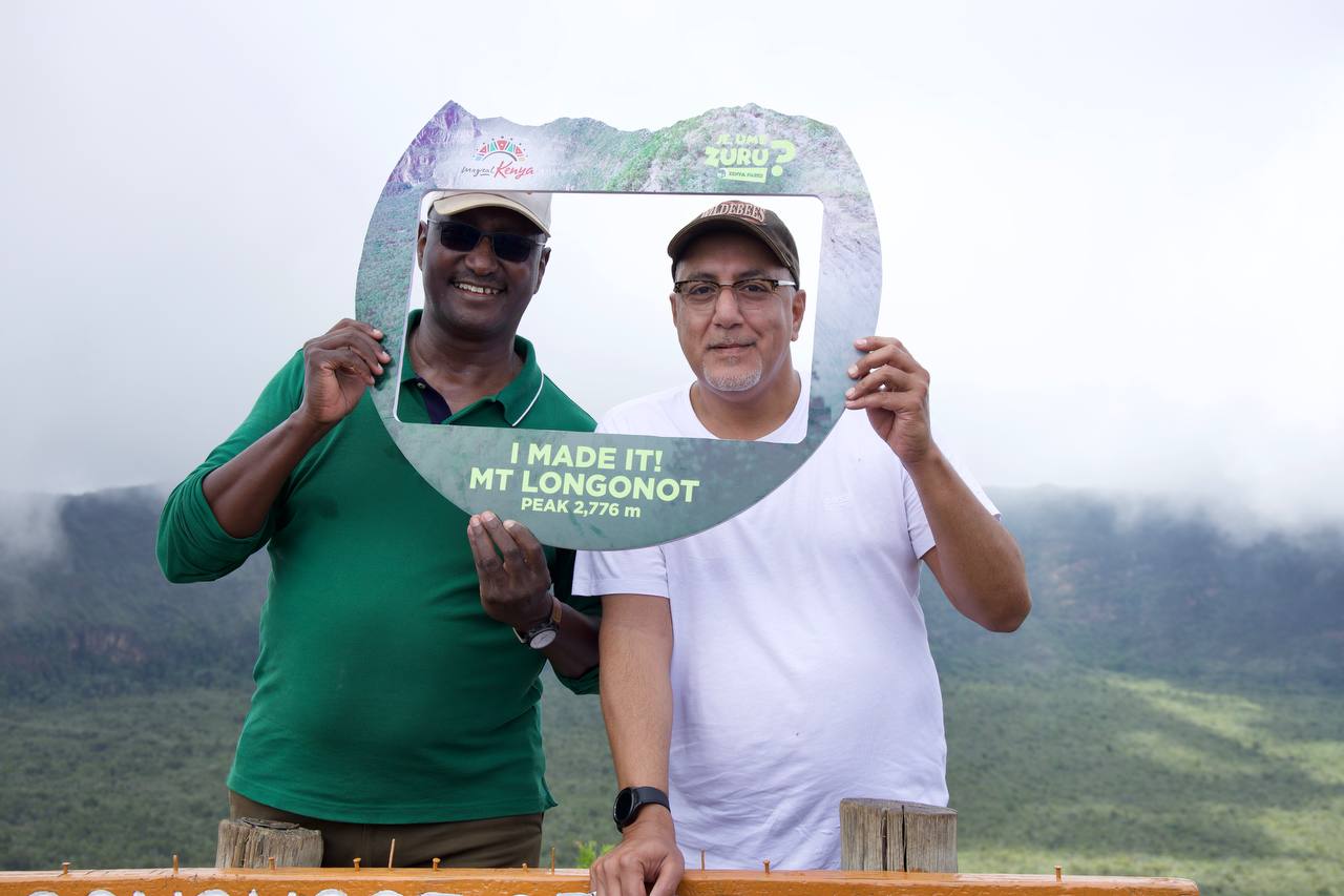
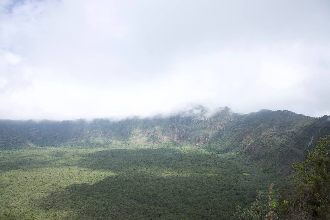


Through this campaign, it is an inevitability that the Ministry of Tourism is hoping to avert. Balala expressed optimism at the growing trend of adventure tourism while highlighting that Mt Longonot has received at least 0.5 million visits from Kenyan citizens since 2010, 50,000 of whom visited during the pandemic. To make it more attractive, he noted that the introduction of a cable car, whose plans are underway, would add to the park dubbed ‘Sheer Adventure’. Derived from the Maasai word “Oloonong’ot” meaning “Mountains of Many Spurs and Ridges”, Mt Longonot rises from the floor of the Great Rift Valley like a monolith. A unique feature is the thick forest that lies within the mountain’s crater. The crater rim also provides great scenic views across the beautiful Rift Valley all the way to Lake Naivasha. Located 90kilometres from the capital, Nairobi and 74kilometres from Nakuru City in the Lake Naivasha Basin, the park was gazetted under the Legal Notice Number 13 of January 26,1983.
Mt. Longonot National Park covers an area of 52square-kilometres, most of it occupied by the mountain. The flanks of the volcanic mountain have beautiful V-shaped valleys and ridges while the stony soils have little vegetation. The crater has an impenetrable forest and due to the nature of the terrain, Mt. Longonot has no roads as such; visitors have to hike up and go round the rim of the crater to fully experience the sheer adventure of the great outdoors. Major wildlife attractions at Mount Longonot include buffaloes, elands, lion, leopard, bushbucks, common zebra, giraffe and Grant’s gazelles. Elephants from Narok are a recent phenomenon showing that Mt Longonot dispersal area. Camping is possible and a plan wreckage from December 24, 1968 discovered here.
Adventure tourism has massive potential and other popular mountaineering and hiking destinations include, but not limited to, Ngong Hills, Menengai Crater, and Mt Elgon. 14 kilometre hike from base and around the rim. The 765.7 square-kilometre Aberdare ranges is particularly preferred by most hikers for its diverse topography that features glorious waterfalls, rocky outcrops, canyon like V-shaped valleys, mountain ranges and peaks that reach around 14, 000 feet including Ol Donyo Lesatima (4,001m), Kinangop (3,906m), Elephant Hill (3,906m), Chebuswa Hill (3,364m) and Twin Hills (3,300m). It also boasts an enviable proximity to the capital that makes it ideal for a day visit.